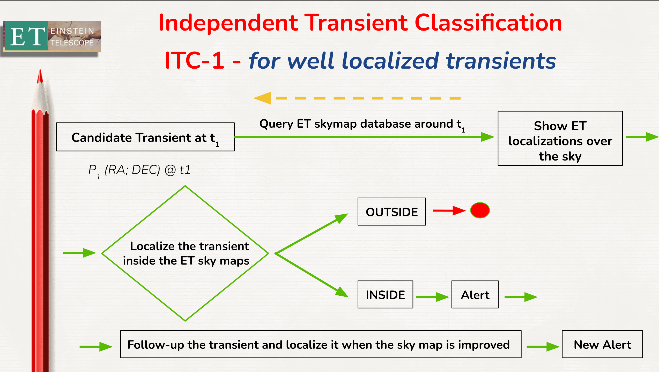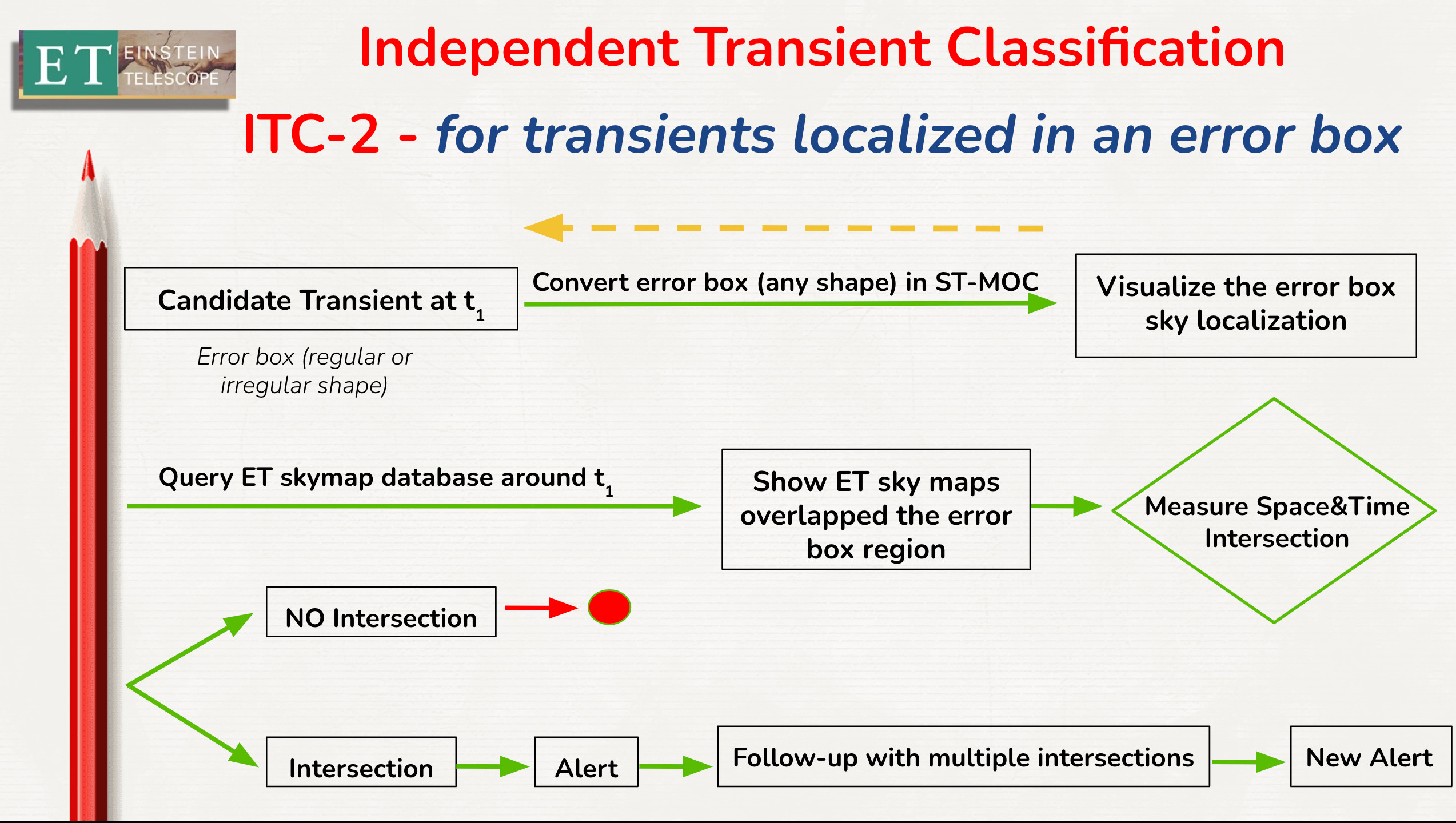
We present a new application to enable the efficient computation of sky regions and the visibility of these regions in the cases where astrophysical sources may be localized in relatively large sky regions, and the planning cannot be done point by point.
This occurs quite frequently in the transient multimessenger astronomy with gravitational-wave sky localizations, error boxes of the short GRBs and neutrino candidate detections.
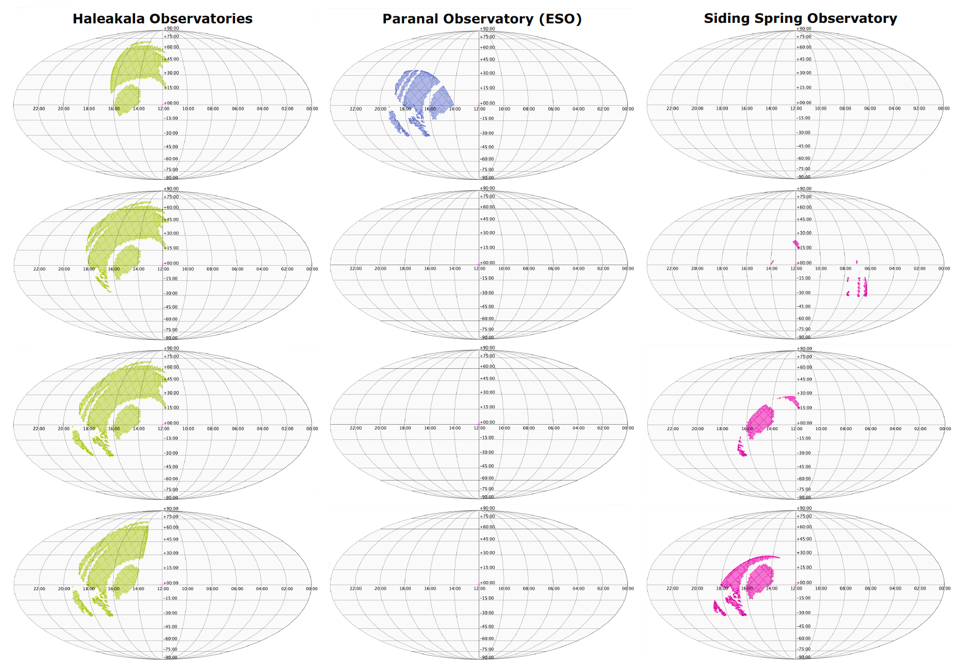
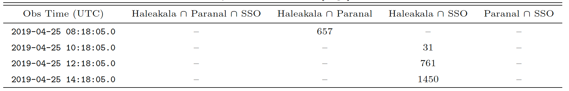
We describe a practical approach that uses Multi-Order Coverage (MOC) maps to describe regions on the sky that are observable from given locations on the Earth, taking into account specific constraints on the airmass values and the time allocated for the observation.
Operationally, this approach uses Python modules for the creation and manipulation of MOCs (mocpy) and for use of the HEALPix tessellation (cds-healpix-python), combined with the astroplan package to select the HEALPix indices at a given order and to set up a new MOC map that represents the visibility with all of these constraints taken into account.
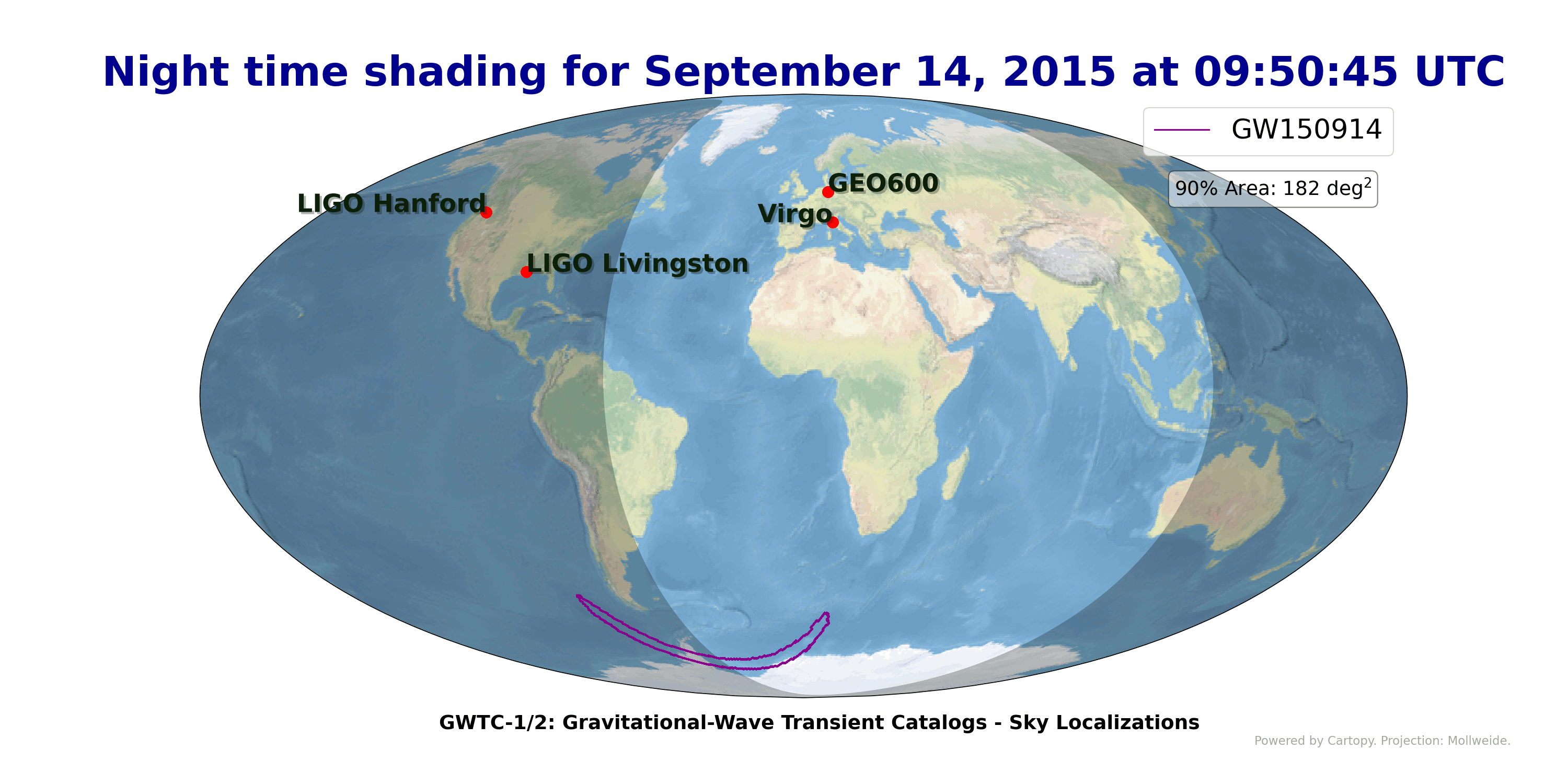
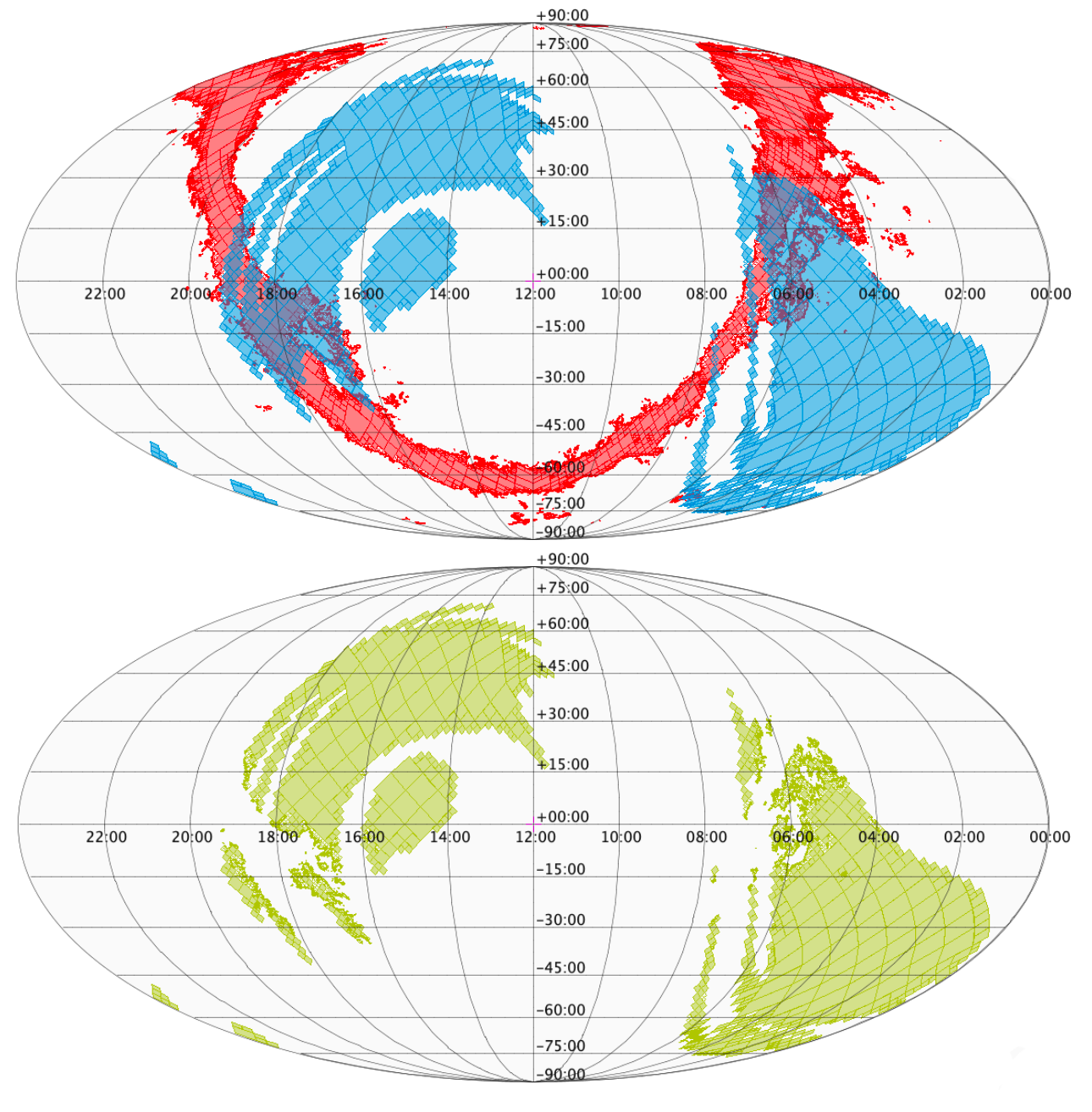
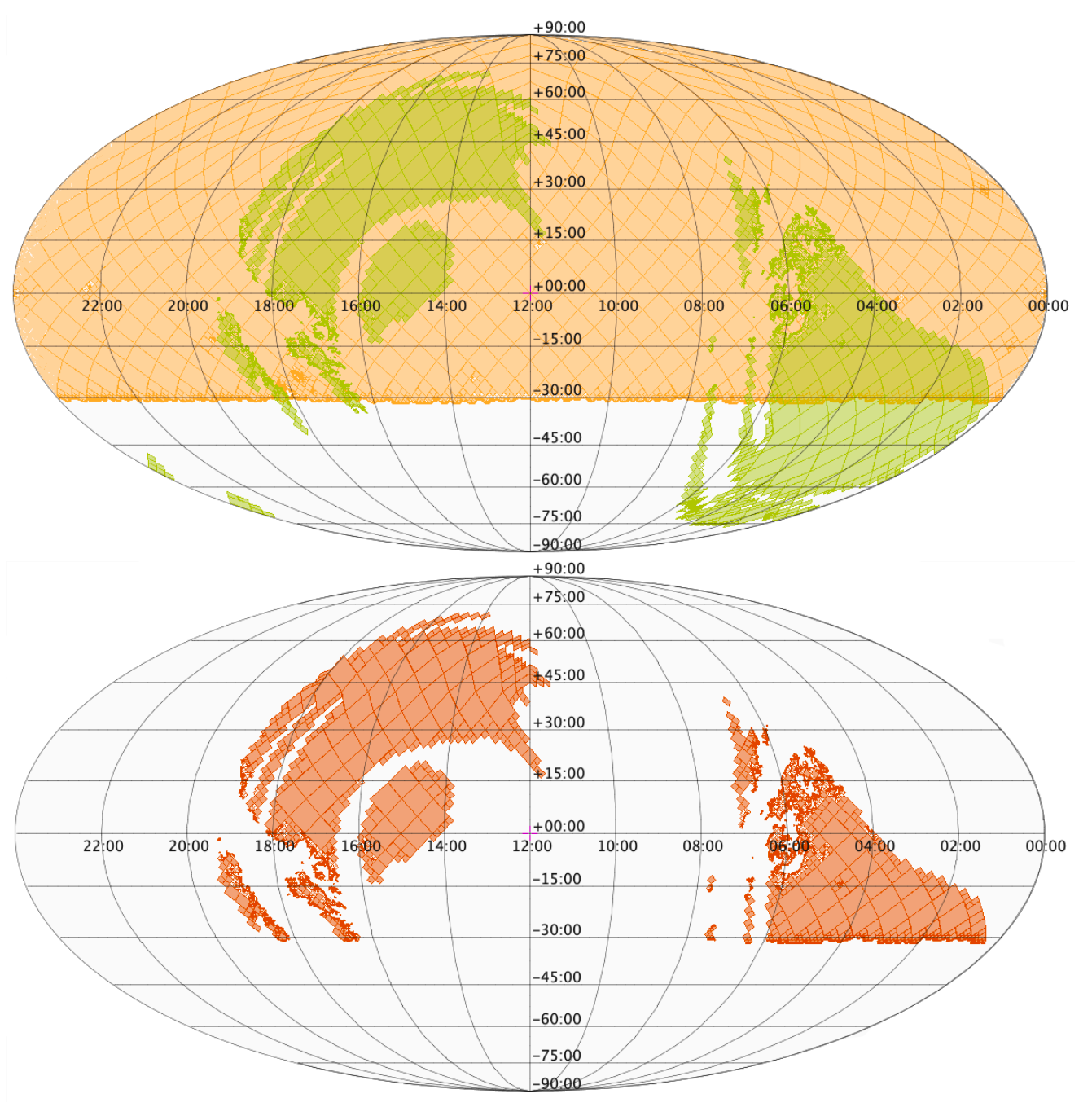
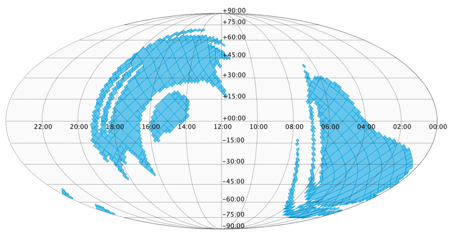
The animated gif shows the gravitational-wave sky localization detected so far in geographycal coordinates with the Day/Night Terminator at the merger time.